A systematic review of artificial intelligence approaches for sedimentation modeling in hydrological systems

Downloads
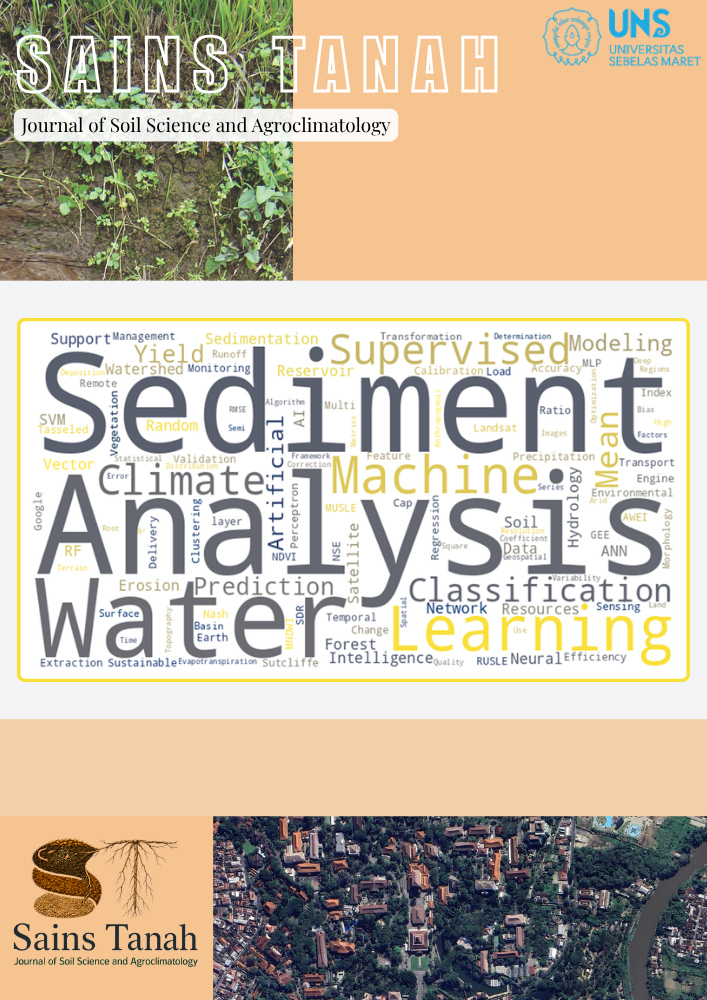
Soil erosion and sedimentation are important environmental challenges, particularly within data-scarce and climate-sensitive regions. Accurate sediment yield prediction is essential for mitigating reservoir siltation and supporting sustainable land and water management. This study systematically reviews and synthesizes recent applications of Artificial Intelligence (AI) in sedimentation modeling, clearly outlining its objectives, screening scope, key findings, and novelty. From 277 screened publications, 16 studies were selected following the PRISMA 2020 guidelines. The results show that hybrid AI models, which integrate physical process-based equations with data-driven algorithms (ANN and LSTM), consistently outperform traditional and standalone machine learning approaches, improving R² by up to 15% and reducing the RMSE by 25-40%. The integration of Google Earth Engine (GEE) enables multi-source remote sensing, climatic, and hydrological data fusion, enhancing spatiotemporal sediment monitoring and reproducibility. Despite these advances, challenges remain regarding data quality, computational cost, and model transferability. This review contributes a standardized and reproducible framework to assess AI-based sedimentation models and to outline future research directions towards scalable, interpretable, and climate-resilient sediment management.
Downloads
Ahmad, W. S., Jamal, S., Taqi, M., El-Hamid, H. T. A., & Norboo, J. (2022). Estimation of soil erosion and sediment yield concentrations in Dudhganga watershed of Kashmir Valley using RUSLE & SDR model. Environment, Development and Sustainability, 26(1), 215-238. https://doi.org/10.1007/s10668-022-02705-9
Allawi, M. F., Sulaiman, S. O., Sayl, K. N., Sherif, M., & El-Shafie, A. (2023). Suspended sediment load prediction modelling based on artificial intelligence methods: The tropical region as a case study. Heliyon, 9(8). https://doi.org/10.1016/j.heliyon.2023.e18506
Amani, M., Ghorbanian, A., Ahmadi, S. A., Kakooei, M., Moghimi, A., Mirmazloumi, S. M.,…Brisco, B. (2020). Google Earth Engine Cloud Computing Platform for Remote Sensing Big Data Applications: A Comprehensive Review. IEEE Journal of Selected Topics in Applied Earth Observations and Remote Sensing, 13, 5326-5350. https://doi.org/10.1109/JSTARS.2020.3021052
Andualem, T. G., Hewa, G. A., Myers, B. R., Peters, S., & Boland, J. (2023). Erosion and Sediment Transport Modeling: A Systematic Review. Land, 12(7), 1396. https://doi.org/10.3390/land12071396
Asaly, S., Gottlieb, L.-A., Yair, Y., Price, C., & Reuveni, Y. (2023). Predicting Eastern Mediterranean Flash Floods Using Support Vector Machines with Precipitable Water Vapor, Pressure, and Lightning Data. Remote Sensing, 15(11), 2916. https://doi.org/10.3390/rs15112916
Bassairate, O., Chikhaoui, M., Naimi, M., & Sabir, M. (2021). Effets de la dynamique de la végétation sur le rythme d’envasement et la disponibilité de l’eau dans le barrage Makhazine (Maroc) [Effects of vegetation dynamics on the rate of siltation and water availability in the Makhazine Dam (Morocco)]. Revue Marocaine des Sciences Agronomiques et Vétérinaires, 9(4), 553-561. https://www.agrimaroc.org/index.php/Actes_IAVH2/article/view/1037
Batista, P. V. G., Laceby, J. P., Davies, J., Carvalho, T. S., Tassinari, D., Silva, M. L. N.,…Quinton, J. N. (2021). A framework for testing large-scale distributed soil erosion and sediment delivery models: Dealing with uncertainty in models and the observational data. Environmental Modelling & Software, 137, 104961. https://doi.org/10.1016/j.envsoft.2021.104961
Bezak, N., Borrelli, P., MikoÅ¡, M., Jemec AufliÄ, M., & Panagos, P. (2024). Towards multi-model soil erosion modelling: An evaluation of the erosion potential method (EPM) for global soil erosion assessments. CATENA, 234, 107596. https://doi.org/10.1016/j.catena.2023.107596
Borrelli, P., Robinson, D. A., Panagos, P., Lugato, E., Yang, J. E., Alewell, C.,…Ballabio, C. (2020). Land use and climate change impacts on global soil erosion by water (2015-2070). Proceedings of the National Academy of Sciences, 117(36), 21994-22001. https://doi.org/10.1073/pnas.2001403117
Chen, G., & Chen, J. (2015). A novel wrapper method for feature selection and its applications. Neurocomputing, 159, 219-226. https://doi.org/10.1016/j.neucom.2015.01.070
Chen, H., Yang, L., & Wu, Q. (2023). Enhancing Land Cover Mapping and Monitoring: An Interactive and Explainable Machine Learning Approach Using Google Earth Engine. Remote Sensing, 15(18), 4585. https://doi.org/10.3390/rs15184585
Dallahi, Y., Malaainine, M. E. I., Dansou, C., Hbiak, I., Boujraf, A., & Orlando, C. A. (2025). Prediction of current and future gully erosion susceptibility in the Oued Zat watershed in the High Atlas region of Morocco using an SVM-based machine learning approach. Arid Land Research and Management, 39(2), 151-179. https://doi.org/10.1080/15324982.2024.2390477
El Bilali, A., Taleb, A., El Idrissi, B., Brouziyne, Y., & Mazigh, N. (2020). Comparison of a data-based model and a soil erosion model coupled with multiple linear regression for the prediction of reservoir sedimentation in a semi-arid environment. Euro-Mediterranean Journal for Environmental Integration, 5(3), 64. https://doi.org/10.1007/s41207-020-00205-8
Froehlich, D., & Giri, S. (2019). Neural Network Prediction of Reservoir Sedimentation. https://doi.org/10.13140/RG.2.2.17962.77764
Ghorbani, M. A., Hosseini, S. H., Fazelifard, M. H., & Abbasi, H. (2013). Sediment load estimation by MLR, ANN, NF and sediment rating curve (SRC) in Rio Chama river. Journal of Civil Engineering and Urbanism, 3(4), 136-141. https://www.ojceu.com/main/attachments/article/26/J.%20Civil%20Eng.%20Urban.,22-136-141.pdf
Gourfi, A., Daoudi, L., & Shi, Z. (2018). The assessment of soil erosion risk, sediment yield and their controlling factors on a large scale: Example of Morocco. Journal of African Earth Sciences, 147, 281-299. https://doi.org/10.1016/j.jafrearsci.2018.06.028
Hajigholizadeh, M., Melesse, A. M., & Fuentes, H. R. (2018). Erosion and Sediment Transport Modelling in Shallow Waters: A Review on Approaches, Models and Applications. International Journal of Environmental Research and Public Health, 15(3), 518. https://www.mdpi.com/1660-4601/15/3/518
Heckmann, T., Cavalli, M., Cerdan, O., Foerster, S., Javaux, M., Lode, E.,…Brardinoni, F. (2018). Indices of sediment connectivity: opportunities, challenges and limitations. Earth-Science Reviews, 187, 77-108. https://doi.org/10.1016/j.earscirev.2018.08.004
Hitouri, S., Varasano, A., Mohajane, M., Ijlil, S., Essahlaoui, N., Ali, S. A.,…Teodoro, A. C. (2022). Hybrid Machine Learning Approach for Gully Erosion Mapping Susceptibility at a Watershed Scale. ISPRS International Journal of Geo-Information, 11(7), 401. https://www.mdpi.com/2220-9964/11/7/401
Iraji, H., Mohammadi, M., Shakouri, B., & Meshram, S. G. (2020). Predicting reservoir volume reduction using artificial neural network. Arabian Journal of Geosciences, 13(17), 835. https://doi.org/10.1007/s12517-020-05772-2
Jha, S., Dixit, S., Mehta, D., Verma, S., Shaikh, M. M., & Patel, P. (2024). Assessment of Reservoir Sedimentation Using Geospatial Tools: A Case Study of Kadana Reservoir. Journal of Environmental Informatics Letters, 93-100. https://doi.org/10.3808/jeil.202400129
Jooshaki, M., Nad, A., & Michaux, S. (2021). A Systematic Review on the Application of Machine Learning in Exploiting Mineralogical Data in Mining and Mineral Industry. Minerals, 11(8), 816. https://doi.org/10.3390/min11080816
Jothiprakash, V., & Garg, V. (2009). Reservoir Sedimentation Estimation Using Artificial Neural Network. Journal of Hydrologic Engineering, 14(9), 1035-1040. https://doi.org/10.1061/(ASCE)HE.1943-5584.0000075
Kanito, D., Bedadi, B., & Feyissa, S. (2023). Sediment yield estimation in GIS environment using RUSLE and SDR model in Southern Ethiopia. Geomatics, Natural Hazards and Risk, 14(1), 2167614. https://doi.org/10.1080/19475705.2023.2167614
Karyati, K., Sarminah, S., Karmini, K., Akbar, A. M., & Hermansyah, R. (2021). Conservation and economic aspects of a combination of forestry-agricultural crops (Neolamarckia cadamba-Phaseolus vulgaris) and terrace systems in different slope classes. Sains Tanah Journal of Soil Science and Agroclimatology, 18(1), 9. https://doi.org/10.20961/stjssa.v18i1.47708
Kazemi Garajeh, M., Haji, F., Tohidfar, M., Sadeqi, A., Ahmadi, R., & Kariminejad, N. (2024). Spatiotemporal monitoring of climate change impacts on water resources using an integrated approach of remote sensing and Google Earth Engine. Scientific Reports, 14(1), 5469. https://doi.org/10.1038/s41598-024-56160-9
Koch, N., zu Ermgassen, E. K. H. J., Wehkamp, J., Oliveira Filho, F. J. B., & Schwerhoff, G. (2019). Agricultural Productivity and Forest Conservation: Evidence from the Brazilian Amazon. American Journal of Agricultural Economics, 101(3), 919-940. https://doi.org/10.1093/ajae/aay110
Lee, F.-Z., Lai, J.-S., & Sumi, T. (2022). Reservoir Sediment Management and Downstream River Impacts for Sustainable Water Resources—Case Study of Shihmen Reservoir. Water, 14(3), 479. https://doi.org/10.3390/w14030479
Meshram, S. G., Singh, V. P., Kisi, O., Karimi, V., & Meshram, C. (2020). Application of Artificial Neural Networks, Support Vector Machine and Multiple Model-ANN to Sediment Yield Prediction. Water Resources Management, 34(15), 4561-4575. https://doi.org/10.1007/s11269-020-02672-8
Nourani, V. (2014). A review on applications of artificial intelligence-based models to estimate suspended sediment load. International Journal of Soft Computing and Engineering, 3(6), 121-127. https://www.ijsce.org/portfolio-item/F2009013614/
Pakdel-Khasmakhi, H., Vazifedoust, M., Paudyal, D. R., Chadalavada, S., & Alam, M. J. (2022). Google Earth Engine as Multi-Sensor Open-Source Tool for Monitoring Stream Flow in the Transboundary River Basin: Doosti River Dam. ISPRS International Journal of Geo-Information, 11(11), 535. https://www.mdpi.com/2220-9964/11/11/535
Panagos, P., & De Rosa, D. (2023). Indicators to support the soil perspectives of the Common Agricultural Policy (CAP). Publications Office of the European Union. https://doi.org/10.2760/235604
Pimple, U., Simonetti, D., Sitthi, A., Pungkul, S., Leadprathom, K., Skupek, H.,…Towprayoon, S. (2018). Google earth engine based three decadal landsat imagery analysis for mapping of mangrove forests and its surroundings in the trat province of Thailand. Journal of Computer and Communications, 6(01), 247-264. https://doi.org/10.4236/jcc.2018.61025
Rehman, S. A. U., Bui, M. D., Riaz, Z., & Rutschmann, P. (2016). Estimation of Sediment Yield for Dasu Hydropower Project Using Artificial Neural Networks Conference: 18. Wasserbau-Symposium 2016At: Wallgau Germany, https://www.cee.ed.tum.de/fileadmin/w00cbe/wb/freunde/Symposium_2016/Beitraege_Wallgau2016/32_-_Rehman.pdf
Sarkar, A., Sharma, N., & Singh, R. D. (2017). Sediment Runoff Modelling Using ANNs in an Eastern Himalayan Basin, India. In N. Sharma (Ed.), River System Analysis and Management (pp. 73-82). Springer Singapore. https://doi.org/10.1007/978-981-10-1472-7_5
Singh, A., Imtiyaz, M., Isaac, R. K., & Denis, D. M. (2012). Comparison of soil and water assessment tool (SWAT) and multilayer perceptron (MLP) artificial neural network for predicting sediment yield in the Nagwa agricultural watershed in Jharkhand, India. Agricultural Water Management, 104, 113-120. https://doi.org/10.1016/j.agwat.2011.12.005
Singh, G., & Panda, R. K. (2011). Daily sediment yield modeling with artificial neural network using 10-fold cross validation method: a small agricultural watershed, Kapgari, India. International Journal of Earth Sciences and Engineering, 4(6), 443-450. https://www.researchgate.net/profile/Gurjeet-Singh-8/publication/265988179
Sujon, K. M., Hassan, R. B., Towshi, Z. T., Othman, M. A., Samad, M. A., & Choi, K. (2024). When to Use Standardization and Normalization: Empirical Evidence From Machine Learning Models and XAI. IEEE Access, 12, 135300-135314. https://doi.org/10.1109/ACCESS.2024.3462434
Taheri Dehkordi, A., Valadan Zoej, M. J., Ghasemi, H., Ghaderpour, E., & Hassan, Q. K. (2022). A New Clustering Method to Generate Training Samples for Supervised Monitoring of Long-Term Water Surface Dynamics Using Landsat Data through Google Earth Engine. Sustainability, 14(13), 8046. https://doi.org/10.3390/su14138046
Tamiminia, H., Salehi, B., Mahdianpari, M., Quackenbush, L., Adeli, S., & Brisco, B. (2020). Google Earth Engine for geo-big data applications: A meta-analysis and systematic review. ISPRS Journal of Photogrammetry and Remote Sensing, 164, 152-170. https://doi.org/10.1016/j.isprsjprs.2020.04.001
Tao, H., Al-Khafaji, Z. S., Qi, C., Zounemat-Kermani, M., Kisi, O., Tiyasha, T.,…Yaseen, Z. M. (2021). Artificial intelligence models for suspended river sediment prediction: state-of-the art, modeling framework appraisal, and proposed future research directions. Engineering Applications of Computational Fluid Mechanics, 15(1), 1585-1612. https://doi.org/10.1080/19942060.2021.1984992
Tfwala, S. S., & Wang, Y.-M. (2016). Estimating Sediment Discharge Using Sediment Rating Curves and Artificial Neural Networks in the Shiwen River, Taiwan. Water, 8(2), 53. https://doi.org/10.3390/w8020053
Trinugroho, M. W., Arif, S. S., Susanto, S., Nugroho, B. D. A., & Prabowo, A. (2022). Changes in Rainfall Pattern in Bengawan Solo Sub-Watershed. Sains Tanah Journal of Soil Science and Agroclimatology, 19(2), 12. https://doi.org/10.20961/stjssa.v19i2.61640
Uroš, D., Tara, O., Aleksandar, K., & Marija, P. (2024). Zaštita prirode life and nature primena GIS-a i ERM modela u proceni intenziteta erozije zemljišta u slivu reke Lugomir [Application of GIS and EPM model in assessment of soil erosion intensity in the Lugomir river basin]. Zaštita prirode, 74(1), 1-11. https://doi.org/10.5937/ZasPri2401001D
Wang, H.-W., Kondolf, M., Tullos, D., & Kuo, W.-C. (2018). Sediment Management in Taiwan’s Reservoirs and Barriers to Implementation. Water, 10(8), 1034. https://doi.org/10.3390/w10081034
Xiong, M., & Leng, G. (2024). Global soil water erosion responses to climate and land use changes. CATENA, 241, 108043. https://doi.org/10.1016/j.catena.2024.108043
Yadav, A., Joshi, D., Kumar, V., Mohapatra, H., Iwendi, C., & Gadekallu, T. R. (2022). Capability and Robustness of Novel Hybridized Artificial Intelligence Technique for Sediment Yield Modeling in Godavari River, India. Water, 14(12), 1917. https://doi.org/10.3390/w14121917
Yan, X.-q., Jiao, J.-y., Tang, B.-z., Liang, Y., & Wang, Z.-j. (2022). Assessing sediment connectivity and its spatial response on land use using two flow direction algorithms in the catchment on the Chinese Loess Plateau. Journal of Mountain Science, 19(4), 1119-1138. https://doi.org/10.1007/s11629-021-6936-7
Yang, L., Driscol, J., Sarigai, S., Wu, Q., Chen, H., & Lippitt, C. D. (2022). Google Earth Engine and Artificial Intelligence (AI): A Comprehensive Review. Remote Sensing, 14(14), 3253. https://doi.org/10.3390/rs14143253
Zhao, T., Wang, S., Ouyang, C., Chen, M., Liu, C., Zhang, J.,…Wang, L. (2024). Artificial intelligence for geoscience: Progress, challenges, and perspectives. The Innovation, 5(5), 100691. https://doi.org/10.1016/j.xinn.2024.100691
Zhu, Y.-M., Lu, X. X., & Zhou, Y. (2007). Suspended sediment flux modeling with artificial neural network: An example of the Longchuanjiang River in the Upper Yangtze Catchment, China. Geomorphology, 84(1), 111-125. https://doi.org/10.1016/j.geomorph.2006.07.010
- Authors retain copyright and grant the journal right of first publication with the work simultaneously licensed under a Creative Commons Attribution-NonCommercial License that allows others to Share (copy and redistribute the material in any medium or format) and Adapt (remix, transform, and build upon the material) the work non-commercially with an acknowledgement of the work's authorship and initial publication in this journal.
- Authors are able to enter into separate, additional contractual arrangements for the non-exclusive distribution of the journal's published version of the work (e.g., post it to an institutional repository or publish it in a book), with an acknowledgement of its initial publication in this journal.
- Authors are permitted and encouraged to post their work online (e.g., in institutional repositories or on their website) prior to and during the submission process, as it can lead to productive exchanges, as well as earlier and greater citation of published work (See The Effect of Open Access).